Drones and UAVs
The term ‘drone’ refers to an uncrewed aircraft which can be controlled remotely. Drones come in multiple forms, and can be small enough to fit in your hand or large enough to carry people.
On this page you’ll learn about drones and UAVs in four quick sections. Here’s a rundown of what to expect👇🏽
-
We’ll start off with just enough to help you demistify Drones and UAVs: Five key facts to dip your toes in, the answers to five questions we often get asked and five buzzwords to learn (so that you can start using them in conversation!)
-
What can drones actually be used for? They are commonly used to support development and humanitarian outcomes by collecting images and carrying cargo, but there’s a lot more potential to discover!
Once you’re explored different uses, jump into stories from our pilot portfolio, where they’re testing drones and UAVs in the field.
-
Evidence is at the heart of the Frontier Tech Hub, and we’ve collated insights from our portfolio and thought leadership from FCDO Pioneers in this section. Dig into our research to look deeper at how drones and UAVs can be used within FCDO programmes.
-
More resources, however you like to consume. We’ve created a playlist of podcasts, reports, articles and videos to continue your journey. There’s something for everyone.
Facts and Buzzwords
Fact file
💻 Drone pilots can control the drone from a handheld controller and visual line of sight, or they might be sat at a computer thousands of miles away! Pilots communicate with drones using radio waves, in some cases transmitted via satellites.
⚡There are 20+ main types of drone, but are all classified differently depending on their weight, range, degree of autonomy, and level of altitude.
✈️Currently the most enduring drone can fly for up to 45 hours, but tests on solar-powered drones show that this could increase to 5 years at a time.
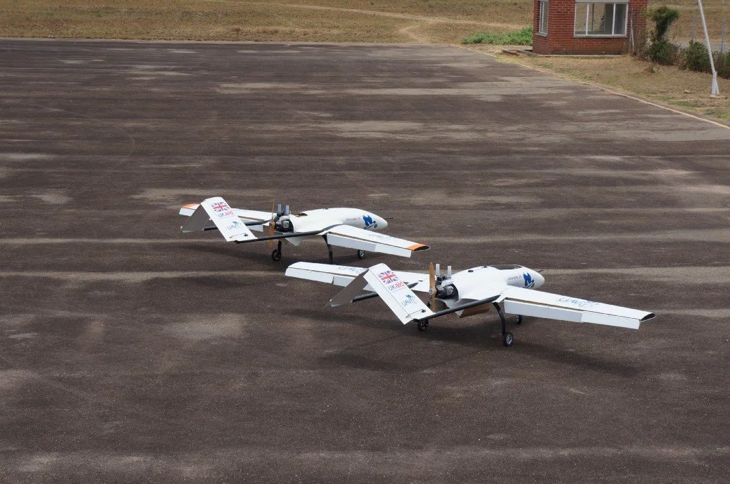
A UAVAid drone being tested to deliver cargo to the Malawi Healthcare Supply Chain in 2019
📋 Drones are usually regulated by a country’s Civil Aviation Authority. The restrictions and controls around their use depend on the type of drone, what it is being used for and what equipment and cargo it is carrying. The regulatory authority will be concerned with the physical risks to people and infrastructure under the flight path, interference with other aircraft and protecting the privacy and security of individuals and restricted areas.
🪆Drones come in different sizes. Wingspans range from a few centimetres to about 60 metres (200 ft), the size of regular, manned aircraft.
FAQs
-
The term ‘drone’ refers to an uncrewed aircraft which can be controlled remotely. Typically, An Uncrewed Aerial Vehicle (UAV) is used in reference only to aircraft that can fly autonomously or remotely. Although the terms “UAV” and “drone” are used interchangeably in practically all articles, websites, and news, we must make a distinction that not all drones are UAVs. Both refer only to the machine itself, whereas, Unmanned Aerial Systems (UAS) refers to not just the ‘drone’ or vehicle but also the operator pilot, the air control systems, software, GPS, and other infrastructure. See the UK Civil Aviation Authority's guide to UAS for more information.
-
It’s important to start by understanding the problem, only then can you assess if drones are a suitable and affordable solution. The cost of UAS varies depending on the use case, and therefore the type of drone or UAV appropriate for the task, the location and distances involved, the length of operations (emergency response or sustainable operations), the existence of local suppliers and supporting infrastructure.
It has been demonstrated that UAVs can offer solutions to real challenges, for example timely deliveries to remote health clinics or more targeted crop spraying (see more use cases in this report from the Africa Drone Forum) but whether UAVs present a value for money solution, or in which circumstances they may do so, is a more challenging question to answer.
-
There are a growing number of drone or UAV developers and operators so it’s important to consider what you need when selecting a supplier.
What type of UAV is required, is it about carrying the maximum payload, covering large distances or high quality mapping? Will you need to land to offload cargo? How many UAVs will you need to deliver the service? Is the supplier offering a service agreement or only supplying the technology? Will it be possible to repair or replace parts locally?
The FT Hub has worked with eight different partners on nine UAV pilots. The medical drone delivery database is a useful reference, as is the list of participants at the Africa Drone Forum Expo. There’s a need to support local skills development and local entrepreneurs to encourage local innovation and solutions. The Africa Drone and Data Academy is leading the way in supporting the next generation of drone pilots and data analysers.
All things to consider when identifying the best fit supplier for your work.
-
Whether you need a licence will depend on the type of drone, what the drone is being used for and local laws and regulations. The use of UAVs or drones is typically governed by regulation in the country of use. You can find information on Country Regulations on the International Civil Aviation Organisation website. Some countries operate drone testing corridors which provide a controlled environment for testing drone technology and conducting demo flights prior to applying for licences to operate elsewhere. For example, the Malawi humanitarian drone testing corridor provides a controlled platform for the private sector, universities and other partners to explore how drones can help deliver services that benefit communities.
The Humanitarian Code of Conduct and Guidelines is also a useful reference for those operating in emergency response environments.
-
Community sensitisation is critical and we’ve seen the value of this in our pilots. In the case of Sustained UAV Operations, community engagement was initiated in collaboration with UNICEF’s local partner, College of Medicine, prior to any flights being initiated. Whenever possible the team took a UAV with them so they could show communities the technology. With a view to scaling their solution, Astral Aerial and CABI, implementers of the Drones for Locust Control pilot, have conducted a survey to better understand community perceptions. Time invested in mapping suppliers and building relationships will likely be recouped, as it is crucial to long-term project sustainability.
Stakeholder mapping may be especially valuable in challenging humanitarian contexts, where community sensitisation and acceptance are even more vital. This is because UAVs may carry a military connotation, as noted in FCDO’s policy paper: Unmanned Aerial Vehicles in Development and Humanitarian Contexts.
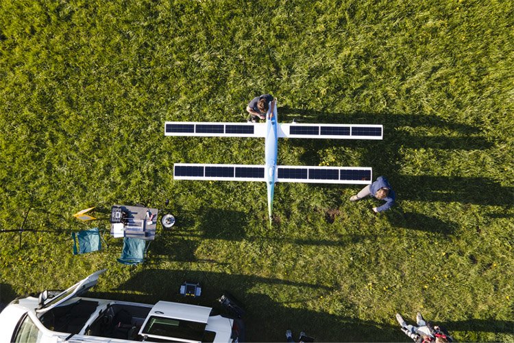
SolarXOne is a solar-powered drone with a tandem wing design. It has excellent aerodynamic performance and a large surface area of solar panels, to collect as much solar energy as possible.
Get to know your buzzwords.
Three final resources on this section
🎬 An Animated History of the Drone
Mashable (9 minute watch)
📘 Quick Guide to Drone Terminology
Air Drone Craze (long list)
Functionality
📘 14 Different Types of Drones
AeroCorner (short list)
What is possibly using UAVs and drones?
Explore stories from the pilot portfolio, testing drones in the field
Three final resources on this section
🎬 Drones delivering Covid 19 vaccines
Mashable (6 minute watch)
📝 Drones for development research
Aid Data (short read)
🎬 Can Drones Deliver?
BBC Click (24 minute watch)
Insights from the Hub
Cross-portfolio resources we’ve created
What we learned from testing drones and UAVs
📄 Read the Portfolio Review
Drones, UAVs and Democracy
📝 A trends article
Optimum Flight Height for the Control of Desert Locusts Using Unmanned Aerial Vehicles (UAV)
📝A research report
5 things we’ve learned from our UAV and drone pilots
📝 Highlights from the Review
What’s ethics got to do with it?
📝A nuanced look at safety and security in drone-enabled healthcare logistics in Africa
Integrating Multi-purpose drones for development in Malawi
🎧 Listen to the podcast episode
Optimum Flight Height for the Control of Desert Locusts Using UAVs
📝A research report
Further learning
Want to dive deeper?
We’ve only scratched the surface of the potential impact drones and UAVs could have in development. We’ve curated a playlist of videos, podcasts and articles to help you keep exploring this topic.
-
An introduction to making high resolution maps using drones from the World Food Programme (14 mins)
The plenary of the Africa Drone Forum 2020 (1 hour)
A panel discussion from the Cargo Drone Virtual Summit entitled ‘Africa: The Continent That Leads The World on Drone Application’ (1 hour 20 mins)
-
-
Optimum Flight Height for the Control of Desert Locusts Using Unmanned Aerial Vehicles (UAV) by CABI
The Drone Evidence Generation Toolkit by VillageReach
Drones for Sustainable Development Goals Toolkit by UNICEF
When to use Drones by the Drones Doing Good Alliance
Unlocking the Lower Skies: The Costs and Benefits of Deploying Drones across Use Cases in East Africa by The World Bank
Medicine from the Sky Opportunities and Lessons from Drones in Africa by The World Economic Forum and Deloitte
Saving Lives from the Sky: Considerations for the Development of Sustainable Drone Programs in Africa by Deloitte


